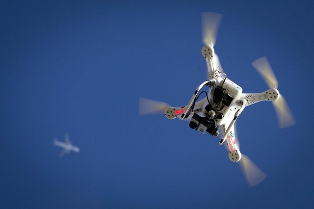
Are you concerned about dreaded fly-aways? No matter if you are a pro flyer or a novice user, there’s always the risk of your precious little birds getting out of control and crash landing out of your sight.
While the cause of drone fly-always is a matter of serious debate, there is no doubt that a drone tracker can come handy to find and recover your valuable asset.
A GPS-based tracker can provide you with accurate positioning details of your lost drone. Information on the longitude and latitude of the location would help you to zero in upon the precise search area – thus improving the likelihood of recovering your unmanned aerial vehicle in the event of a flyaway.
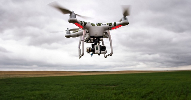
There are a number of GPS-based drone trackers out there in the market. With so many options at your disposal, sometimes things can get a little confusing. To cut short all such confusions, we bring you a handpicked list of the most reliable and popular GPS trackers for locating your lost drone.
1. TRACKIMO
Cost – $139 (Buy here at Tracki.com)
Trackimo GPS Tracker is a light-weight device with a powerful set of features for keeping tabs on your flying machine. It relies on cellular network to coordinate with satellites for finding the precise location of your drone in real-time. It comes with a free app which can be installed on your android/iOS smartphone to track your drone’s activity and flight data. Web-based tracking using a browser program is also possible. Another great feature of Trackimo lies in its ability to send instant alerts on demand. You can manually ping it to find the real-time coordinates of your multi-rotor. It comes with a waterproof case. Even if your drone accidentally lands on a water body, it can still transmit the location details to your mobile. Trackimo is a universal GPS tracker which is compatible with all types of drones and multicopters.
2. FLYTREX LIVE 3G
Cost – $189
Flytrex Live 3G tracks your drone in real-time using GPS technology and transmits its positional data to you via a cellular network. It is like a mini blackbox for your personal drone that has the ability to provide live flight telemetry. It has a micro SIM card slot which is 3G compatible. In the event of a crash or flyaway, it would let you know exactly where your drone has landed. It comes integrated with Google Maps to provide you the direction to arrive at the crash site.
With 3G network coverage, this drone tracker is able to maintain a solid signal strength even during high altitude flights. Apart from drone tracking, this awesome device can also provide you details like altitude, ascent, speed, distance and duration of your flight.
Flytrex Live 3G drone tracker supports a wide variety of multi-rotors including DJI Phantom 1, 2 & 3, Naza-M 1 & 2, WooKong-M, 3D Robotics Iris+, 3DR APM, Blade 350 QX2 & QX3, and Yuneec Q500.
3. TK102
Cost – $29
What makes TK102 GPS Tracker stand apart from the others is its great price. You can get this tiny little drone tracker for as low as just $29. It operates with a GSM SIM card and uses the cellular network to transmit the tracking data. To track your drone, all you need to do is to give it a call. You will instantly receive a text message with time-stamped latitude/longitude coordinates and a link to Google map showing you the precise location of your device.
TK102 is a standalone device that can be attached to all types of drones and quadcopters.
FINAL WORDS
Lots of seasoned drone users have experienced flyaways time and again. Irrespective of whether you are using drones for aerial photography or just want to have some fun, the risk of flyaway will always be there. So it does make sense to invest a few additional bucks for the peace of mind that a drone tracker brings. Isn’t it better to be safe than sorry? The choice is yours.
This is a guest post from Jack Danielson, a drone enthusiast, geek and writer. He is particularly interested in the proliferation of drones around the world. He holds the position of consultant writer at Bakehouse Aerial, a safe, responsible, and professional drone company for all kinds of videography and photography needs.
Get a GPS Tracker Now!Watch the videos below
https://uavcoach.com/find-lost-drone-3-awesome-gps-drone-trackers/
The FAA drone advisory committee, a committee currently being set up by the Federal Aviation Administration (FAA), is expected to deal with the issues involving drones in the United States. It is after the fact that these unmanned aerial vehicles are now becoming common, so common that they can easily be bought by anyone by simply going to any walk-in store in the vicinity, even with the buyer not having official permission or authorization so much as a warrant.
Scroll down for video
Hierarchy of the FAA Drone Advisory Committee
The FAA drone advisory committee, which is poised to be headed by none other than Brian Krzanich, the CEO of Intel, would border mainly on the use of these kinds of unmanned aircraft. Brian has been brought on board to ensure that competent hands are involved in the process of guiding the advisory committee on the integration of the activities of such unmanned aircraft as drones in the national airspace system.
The FAA has long planned to impose rules regulating the commercial use of drones, and the committee’s formation just further solidified the possibility of this plan getting carried out soon. The much-awaited laws on drones are expected to open opportunities for big companies like Amazon and Google to use the unmanned aircraft for deliveries and other similar operations.
DARTdrones
“By late spring, we plan to finalize Part 107, our small UAS rule, which will allow for routine commercial drone operations,” said FAA administrator Michael Huerta while speaking at a drone event.
Huerta had also said earlier in January that at the end of the spring season, the rules would have already reached a finalization. There has, however, been some skepticism given that the process has always been stalled by a series of delays, one of the most prominent one being missing a Congress-mandated deadline.
Setup of the FAA Drone Advisory Committee
For the new FAA drone advisory committee to be set up, the members would include representatives who are coming from a wide variety of organizations who hold an interest in the drone technology, not exempting manufacturers and operators, pilots, the FAA drone advisory committee itself, providers of application services, NASA, the Department of Defense, and representatives from manned aviation.
The new advisory committee, which would be responsible for making the rules concerning drone flying, would be largely unlike the UAS registration task force, an organization that was equally set up by the FAA.
The UAS registration task force is expected to serve for a much longer time and serve nearly the same purpose as the NextGen Advisory committee that the FAA currently has on the ground, according to Huerta.
Selections of people who would make the cut to come serve on the advisory committee would depend on the FAA alone.
In February of last year, it has already been leaked that the rules that would be made by the FAA drone advisory committee would make it possible for programs such as the Amazon drone delivery to kick-start.
In 2015, company Eachine made a big stride in the market with their introductory 250 Racer, which gave them a massive increase in ranking among contemporaries. Not about to leave with just one hit gadget, the company is set on thrilling their customers once again with the release of the Eachine Assassin 180.
The Eachine Assassin 180
Scroll down for video
DroneDron
What does the Eachine Assassin 180 have to offer?
The Assassin is built with FPV in mind. In a look closer at the unique RC drone, it will be clear why the drone stands out from the rest on the market—with the quadcopter’s pre-built and pre-configured body, it should be easy for you to fly it in no time.
Eachine Assassin 180 comes with GPS, LED lights that change color depending on flight direction, as well as transmission control.
So far, this is the most delicate Eachine, and this is especially designed for intermediate pilots who are trying their hand at FPV racing, although they are encouraged to fly at low power modes and on grassy areas so as to minimize damage.
Components of the Eachine Assassin 180
This FPV-enabled gadget has 5 main components:
First section—made up of legs and a plastic base, which serve as battery house
Second section—base board; this has motors soldered on it, as well as FPV transmitter lights at the bottom
Third section—middle structural board where motors and the core frame are affixed to
Fourth section—the top board, which houses the USB Port, FC Board, and GPS chip for navigation purposes
Final frame—the mount for the camera
If you wish to attach a radio receiver, it can be mounted in the available space between the third and fourth segment or between the middle and top boards. The Assassin 180 is powered by an 11.1V, 1000mAh 8 pin battery, which is especially designed for them.
The Eachine VR-007 FPV Goggles
Bang Good
The package also comes with VR-007 glasses, which are bigger and heavier than the conventional ones. Their size, however, should not make them uncomfortable to use as they are especially fitted for their use. The goggles can be charged via USB, and they take with them 7.4V 800mAh batteries.
On to resolution: the VR-007 goggles has a 4.3-inch, 480 x 272 pixel panel, so it’s quality is not too high, despite what advertising says. However, don’t worry too much about the quality, you have the option of adjusting sharpness, contrast, brightness, and saturation so that you can match your preferred video feed. The camera modes are in 16:9 and 4:3 ratios and with a single button located close to the receiver antenna for channel scanning.
There is no shortage of sharp images from the feed’; however, there are some problems of images getting distorted, especially if the resolution is increased. At $399.99, the Eachine Assassin 180 RTF kit is available for your drone videograph pleasure as it is packed with everything you need for your FPV competition, VR-007 FPV headset included.
As technology evolves, pilots are increasingly facing more and more navigating challenges in the sky. Some of the challenges used to be more planes, more bad weather, more birds, but now, it’s about more out-of-control unmanned aerial vehicles or drones. Who wins in this drones vs planes fray?
The growing numbers of drones are becoming troubling to the extent that observers could not really ascertain the ruler of the sky between drone and plane.
Even if it is not certain, yet that the collision between British Airplane and an unknown object on approach to Heathrow Airport recently involved a drone, there have been many other reports of instances of near-misses between planes and unmanned aircraft in the past year.
Drones vs Planes: Who Rules the Sky?
Scroll down for video
With regards to this clash of drones vs planes, the rules have always been there. Drones are not allowed to operate above 120 m and within 5.5 km of an airport unless the operator has obtained a license and permission and cannot be operated close to a fire and emergency situation.
Reports around the world indicate a growing troubling concern as it appears that drone users are ignoring the globally accepted rules of not operating above 120 m and within 5.5 km of an airport.
In 24 recorded cases, drones came within 15 m of a manned aircraft, and in 11 cases the pilots of the aircraft made evasive maneuvers to avoid a drone. The report reveals that 91.9 percent of the cases occurred above 120 m, with the average altitude 1,000 m.
The trend is becoming disturbing to experts as there are likelihood of the incidents getting worse as drone sales soar due to lower prices and greater capability.
In US, it is required that drones users must register at a cost of $5, but only 400,000 users so far have been registered. It is estimated that there are about 2.5 million users.
Britain and Australia do not require registration yet, but both countries maintained same basic rules of banning flying at an altitude of above 120 m and within 5.5 km of an airport.
A positive development, however, is that as regulators around the world are struggling with the new drone phenomenon, responsible manufacturers such as China’s DJI have introduced geofencing technology into its drones to prevent them from being flown into dangerous areas.
While this is good for the responsible users, hacks can be found online by irresponsible operators to work around the restrictions.
In the drones vs planes clash, that is where the problem lays, particularly regarding drones. Without a global mandatory on registration for owners and severe penalties, irresponsible operators will continue to pose serious threats to aviation.
More and more cases of these drones being operated around major airports are being reported.
At New York’s JFK airport this past January, a JetBlue A320 pilot reported a near miss with a drone at about 2,000 m, while a Southwest 737 pilot reported one passing just below his plane as it came into land at Baltimore.
In September last year, a drone came within 20 m of a 70-seat EMB170 jet in the skies above the British Houses of Parliament.
All these call for concern with air travel set to double over the next 20 years and drones sales climbing 30 percent a year, tragedies because of reckless operators could be inevitable. Thus, a drone GPS tracker is crucial to monitor UAVs and prevent them from crashing or flying away.
There have been several calls for all drone operators to at least be licensed, with some experts saying that a competency test is also essential.
Scientists in Nebraska made a new tool that is beneficial to firefighters, and that is to eradicate fire using drones. A Team of experts from University of Nebraska flew a drone over prairie at Homestead National Monument, dropping ping pong like balls with chemical mixture inside that could eradicate grass fires.
Federal officials have shown great interest in this technology because it can help clear unwanted vegetation in hard-to-reach terrain, according to Michael Johnson.
Scroll down for video
The fire-fighting Drone and what it does
Chemical powder (potassium permanganate) is filled in these balls before they are uploaded in drone. When drone reaches its destination, it pierces the ball and injects it with a chemical (glycol) before releasing. This mixture is capable of igniting within a minute or two. This new technology is already being used by helicopters to control burns, but scientists found that drones are much cheaper and can be deployed on a large scale.
How to Eradicate Fire Using Drones
Carrick Detweiler, member of the research team, said, “You could afford one of these on the back of your fire truck, whereas you probably can’t afford to have a full-sized helicopter parked at your fire station.”
The drone, which is two feet wide, is programmed to drop balls in a pattern to control spread fire. Last week, this new drone rose out of ground and hummed toward its destination through smoky haze. Within minutes, it released balls, sparking like series of small fires, merging into one.
Scientists are hoping that this technology will be able to control fires in hard-to-reach areas, clearing small trees and making it difficult for fire to spread further in an area.
This new drone is the fourth one created by Jacob University’s Intelligent Mobile Systems laboratory. It can carry up to 13 balls at a time and drop from 65 feet in air. The drone is capable of carrying one pound of cargo. Based on the software that they used, drone developed by research team costs between $6,000 and $8,000. Similar kind of projects are going on in universities of Colorado, Switzerland, and Pennsylvania.
How Fire-Fighting Drones Are Made
Higgins said that there were many ups and downs in earlier tests. Balls weren’t exploding where they wanted them to. And sometimes balls were exploding before the drone could even release them. Wind factor can’t be left out when flying something in the air. A lightweight drone can’t work in high winds.
Sebastian Elbaun, a computer science professor and engineering department head, said that firefighters can use drones to gather information and find hot spots.
Elbaum added, “Today, firefighters have maybe a shovel, maybe their gloves and their helmets. Imagine them having this in their backpack, pulling it out and telling it, ‘Hey, go scout out there. Check whether it’s hot. Check whether it’s safe.”
This project started two years ago to find new methods to prevent wildfires in parts of Nebraska. There were about 1,570 wildfires in 2012 in Nebraska, which damaged an area of more than 786 square miles. This is even more expanse than size of Omaha. In 2012, combined cost for ground and air assistance cost more than $11 million.
Researchers will use results of tests to find out how firefighters can use drones in near future, said Brittany Duncan, assistant professor working with research team.
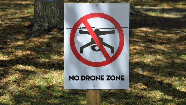
At the moment, a bill that would forbid drones from flying over Wisconsin prisons and permit municipalities to create no-fly zones is drawing hostility from drone operators and technology advocates around the state. Drone owners and operators protest against no-fly zone bill that was proposed.
The proposed bill holds that anyone who flies a drone over a state correctional institution would face a fine up to $5,000. The said bill would also allow municipalities and counties to establish areas where drones cannot be flown. They could impose fines up to $2,500.
Scroll down for video
Rep. Michael Schraa, R-Oshkosh, said he and Sen. Richard Gudex, R-Fond du Lac, proposed the legislation at the request of correctional officers, following a series of cases across the country in which smugglers flew drugs, pornography, or other contraband over prison walls.
Schraa tagged it as a “common-sense legislation,” which will help correctional officers more safely and effectively do their jobs.
However, other speakers at the public hearing in the Senate Committee on Judiciary and Public Safety said the rules would clash with federal regulations and could stifle economic growth potentials from the relatively new technology. Moreover, drone users in Wisconsin protest against no-fly zone bill.
“This bill would create a patchwork of local regulations,” says Consumer Technology Association lobbyist Joe Leibham.
He further explained that the bill, if passed into law, could limit opportunities for commercial drone operators and would conflict with federal authority to regulate airspace.
Prior to this proposed bill, the Federal Aviation Administration (FAA) has beenádeveloping regulations for drones, or unmanned aircraft systems, which now require them to register with the agency. Almost 300,000 drone owners registered in the first month since December 21, 2015, when the requirement started.
Although some local and state lawmakers in the past have criticized the FAA’s rules for being too lenientáand as such, they are coming up with their own rules and regulations. At the committee hearing Wednesday, legislators were unclear on what the FAA’s rules actually are regarding airports or other issues.
Sen. Lena Taylor, D-Madison, initially said she didn’t think the bill went far enough, raising concerns about the potential for drones to impact other large public places while waiting for more regulations from the FAA.á”While we’re waiting, we’re just kind of in limbo,” Taylor said.
Why Drone Operators Protest Against No-Fly Zone Bill?
Bridgeline Tek founder John Christenson and Menet Aero, founder, Peter Menet, both drone operators, said the FAA already has lots of rules regarding unmanned aircraft systems and this bill could hinder economic growth in this arena.
“We have such a strong aviation community here,” said Menet, whose company provides commercial drone operation. “Wisconsin could really benefit from this industry.”
The representative of the Wisconsin Insurance Alliance, Andy Franken, also said they would like an exemption for insurance claims investigators, who are increasingly using drones for analyzing post-disaster instances instead of physically entering the site.
It was concluded that such law if passed could hamper the progress of the new technology while also competing with existing regulations.
Another drone crashed at the White House, this is once again a proof of how easy it is to acquire a drone and crash it the next second. We have heard many flyaway drone stories from drone owners who had similar experienceáand we want to share oneáwith you along with tips on what to do if you lose your drone.
Lost and Found Phantom 2 Vision+
Scroll down for video
Engadget
A few months ago, drone owner Andrew Amato and his team went to a golf course to fly theiráPhantom 2 Vision+. At the time, theáweather was clear, although it was a bit breezy. When theyáreached about 200 feet high, the wind started to pick up until it blew the drone away. Theyáwere forced to activate the Return to Home feature with no avail. The drone was struggling to fly back to them,ábut the wind is just so strong and it almost didn’t move until the battery ran out.
Theyátried to chase it, but to their dismay, it went to the opposite direction, toward Rod and Gun Club. Andrew said he didn’t want to be shot but also wanted to see his GPS drone camera again even if there was a big possibility that it was broken already.
So they alláhurried to the club. Luckily, when theyáarrived, nobody was there. Theyáput on bright colors just in case somebody mistook them for something. For two good hours, they searched and searched but didn’t see anything that resembled their drone. It was already dark when theyádecided to give up.
What they did next sent an e-mail to the club explaining what happened. Theyárequested the members to contact them in case someone found itáand told them they wereáwilling to give a small reward. The people they met, thankfully, were a very approachable bunch and said they would inform themáif it turned up.
In the next two days, snow piled up to 4 inches. Theyáwere crestfallen, theyáwere positive that if ever the Phantom was found, it would be beyond repair.
One week later, theyáreceived a message from the club informing themáthat one of their members had found theiráGPS drone!
To theiráamazement, theirádrone was almost undamaged! The gimbal was still there, the landing gear was untouched, and even the propellers were complete and unscathed. After theyácharged the battery, it’s as if theiráPhantom was brand newŚwell, except that the camera was overturned on the gimbal.
We had some gimbal issues previously so we thought we would have brought it to DJI for repair. But before deciding, we first search on the Internet maybe there was a wayáwe couldáfix it ourselves. We find out that many pilots also had the same problem. We also discovered a video from YouTube which was very helpful. It’s an instruction with a demonstration on how to fix the problem.
It required a steady hand and fortunately, we were able to repair the camera. But another problem came out, the image was blurry and the lens was misty.
What we did was we let it stand for a few days more so when the lens dried out, the camera was functioning again.
It was really incredible, perhaps the drone gods were with us. Imagine our Phantom fell from at least 200 feet above and was left outside frozen two more than a week. We already accepted that our drone was good as gone and yet here we are flying again.
The lessons here are: equip your drone with a quality 3G GPS tracking device like Trackimo so you don’t have to waste time looking for it or wait for some good people out there to turn over your stuff. The moment you lost sight of your drone you can check your GPS tracker as where your Phantom is currently resting. I also learned that there are still good people out there who are willing to help you if you only learn how to ask.
A skilled helicopter pilot has shown his rage at finding a drone that was flying close to him during a fire-fighting procedure in Canterbury last year. He mentioned that it could have flown through his windscreen or even hit him right in the face. The drone almost risked a helicopter crash to occur. This is another instance portraying the risks of unmanned aerial vehicles.
Drone Almost Risked A Helicopter Crash in Canterbury
Kairaki man Simon Roy Reeve, 38, is facing three charges for causing irrelevant risk and flying a drone in a controlled airspace without authorization.
Prosecutors report that he flew his remote-operated drone hazardously close to a Way2Go Heli Services squirrel helicopter fighting a big plantation fire at the Pines Beach in January last year.
David Askin, also known as Steve, showed his rage at seeing drone footage of the fire come up on the news that night.
Scroll down for video
Scoopnest
With the fact the the drone almost risked a helicopter crash, the helicopter pilot and instructor made claims that he was oblivious to the fact that it was in the air during the period of the hazardous operation.
“When I was sitting there watching that footage, I was running through all the possible instances of what could have happened,” he told the court.
“For one it could damage the helicopter, and the helicopter is an expensive piece of equipment. Two, it could bring me down to the ground, cause me to crash,” he added.
Mr. Askin narrated how helicopter pilots normally take the doors off of their aircraft in firefighting procedures and suspend their head outside to present a good view of their monsoon bucket and target. The drone hitting him on the face would have been the worst possible thing that could have happened.
“That thing could come through the windscreen at the pilot. There’s a hundred million different scenarios that could affect the helicopter in a small way to a big way.”
TVNZ Pays for Drone Footage
Proof started this morning with attestation from a crew from TVNZ News that got to the scene to comment on the fire and a series of expulsions close to the plantation.
UAV Expert News
Reporter Joy Reid mentioned to the court that she observed Mr. Reeve directing a remote control in a clearing close to Pines Beach village around mid-afternoon. She couldn’t see the drone at that time and didn’t observe it until Mr. Reeve landed it later that day.
She made an offer to pay Mr. Reeve $200 for his footage and it was broadcast on the 6:00 p.m. news that evening.
The defense has made claims before that Mr. Reeve had perspective with the drone and was capable of seeing it at all times all through the flight.
Camera operator Daniel O’Sullivan stated that the drone had taken scenes he wasn’t capable of filming from the ground. First of all, he observed Mr. Reeve flying the drone in a clearing very close to the plantation, but he reported that it was working in a “completely different location” later in the day.
The judge-alone trial should be finalized soon.
Nevertheless, better attach your drone with a GPS tracking device given if your drone experiences crash-landing, it would be easier to track down.
In a war between drone and hose, there is one defined winner. But was the aircraft pilot foraying privacy, or are the firefighters guilt-ridden of damaging his chattel?
As aircraft become more inexhaustible, people are beginning to drift into two camps: those that cherish them and those (like this chimp) that think they’re privacy-usurping, hazardous irritants. Predict which side a group of firefighters from upstate New York pitched their tent.
Should Drones Fly Over On-Going Fires?
Scroll down for video
CNET
As the firefighters from Montgomery and Coldenham in New York were striving to douse a house that was on fire on June 4, an indigenous man by name John Thompson decided to pilot a drone over the theater to film the proceedings. The firefighters condoned the drone for about 10 minutes, then set up their fire hose at it in what appears to be like infuriation. They spurt another blast its way about a minute later.
Thompson says that his drone is now broken and demands the fire company to pay for a new one at the sum of $2,200. (On a side note, the drone looks like a DJI Phantom 2 Vision, which really costs about $1,000.)
Taking a different look at the argument, however, local police are probing if Thompson went against any laws, according to a news report on News 12 Hudson Valley. The station also recounts that “off camera,” the local district attorney said that “unlawfully surveilling someone with a drone is illegal, but public events are generally allowed to be (filmed).”
The debate about who’s wrong and who’s right in this situation has naturally taken to Thompson’s Facebook page. “If the press is allowed to film a fire call, I have the same right to do this. Look for the law that says I can’t,” posts Thompson.
“I will say one thing: if my house were to burn and I saw that drone above my property, it wouldn’t be there very long,” says Facebook user Mike Townsend in the comments. “I do not want my house being recorded if it’s on fire or for whatever reason by some drone.”
It’s a dodgy debate and one that is only going to accentuate as our friends, neighbors, the police, and even Amazon get the ability to invade our personal airspace.
Was Thompson’s video a solid piece of citizen journalism (it is well-filmed), or was it a blatant invasion of the homeowner’s privacy? On whose side are you pitching your tent?
The Indian Director General for the Civil Aviation (DGCA) has released a draft paper guideline, which gives details on drone use guidelines that need to be followed should the need for a unique identification number (UIN) alongside permission to operate a civilian unmanned aircraft system (UAS) arise. Justifying its need to come up with such guidelines, the DGCA has pointed to the various usage of these unmanned aerial vehicles for ventures such as assessment of damages on property and life in areas that have suffered from natural calamities, conduction of surveys, monitoring infrastructure, taking commercial photographs, drawing aerial maps, and the like as plausible reasons that require a set of rules to be drawn. As far back as April 2015, it had been reported that the DGCA was in the works, making a set of guidelines that would serve as a counter-measure for drones and UAVs in the country and certify some drones standard and legal.
Below is a snippet of the drone use guidelines as released by the DGCA.
DGCA Issues Drone Use Guidelines
Scroll down for video
1. Issuance of UIN as stated in the drone use guidelines
All unmanned aircraft to be operated in India will require a unique identification number (UIN) issue from the DGCA. This will be granted only to citizens of India or a company or body that is registered and has its principal base of business in India, its chairman and two-thirds of directors are citizens of India, and its ownership and effective control is in the hand of Indian nationals.
To own a drone, one should present the following:
Address proof
Statement of purpose of operation of UA
Specification of the drone including (manufacturer name, type, model number, year of manufacture, weight and size, type of propulsion system, flying capabilities in terms of maximum endurance, range and height, equipment capabilities, etc.)
Police clearance of character
Permission for all frequencies used in drone operations from the Department of Telecommunications (it’s not clear if permission is required to operate using unlicensed spectrum like WiFi)
Copy of the flight manual
Manufacturer-provided maintenance guidelines
Fireproof ID plate on drone
Finally, users will also be required to make a fireproof identification plate and inscribe it with the UIN and an RFID tag, or put a SIM on the UA to for identification.
Upon the completion of all of the above steps, a user would then be qualified to own only one drone.
To fly a drone:
A user needs to secure DGCA’s UA drone operator permit for flying above 200 feet or a permit from the local administration for below 200 feet.
Digital Trends
2. Who are required to present an UA operator permit?
All drone operators operating unmanned aircraft at or above 200 feet above ground level should have a UA operator permit (UAOP) from the DGCA.
Users with drones that operate below that level out of restricted and danger areas as well as temporary segregated areas (TSA) and temporary reserved areas (TRA) will be required to obtain permission from the local administration. Model aircraft operating below 200 feet in uncontrolled airspace and indoor for recreational purposes will be permitted, including activities within the premises of educational institutions.
The rest of the drone use guidelines can be viewed and easily read via the downloadable PDF file online.
 There are a number of GPS-based drone trackers out there in the market. With so many options at your disposal, sometimes things can get a little confusing. To cut short all such confusions, we bring you a handpicked list of the most reliable and popular GPS trackers for locating your lost drone.
1. TRACKIMO
Cost – $139 (Buy here at Tracki.com)
Trackimo GPS Tracker is a light-weight device with a powerful set of features for keeping tabs on your flying machine. It relies on cellular network to coordinate with satellites for finding the precise location of your drone in real-time. It comes with a free app which can be installed on your android/iOS smartphone to track your drone’s activity and flight data. Web-based tracking using a browser program is also possible. Another great feature of Trackimo lies in its ability to send instant alerts on demand. You can manually ping it to find the real-time coordinates of your multi-rotor. It comes with a waterproof case. Even if your drone accidentally lands on a water body, it can still transmit the location details to your mobile. Trackimo is a universal GPS tracker which is compatible with all types of drones and multicopters.
2. FLYTREX LIVE 3G
Cost – $189
Flytrex Live 3G tracks your drone in real-time using GPS technology and transmits its positional data to you via a cellular network. It is like a mini blackbox for your personal drone that has the ability to provide live flight telemetry. It has a micro SIM card slot which is 3G compatible. In the event of a crash or flyaway, it would let you know exactly where your drone has landed. It comes integrated with Google Maps to provide you the direction to arrive at the crash site.
With 3G network coverage, this drone tracker is able to maintain a solid signal strength even during high altitude flights. Apart from drone tracking, this awesome device can also provide you details like altitude, ascent, speed, distance and duration of your flight.
Flytrex Live 3G drone tracker supports a wide variety of multi-rotors including DJI Phantom 1, 2 & 3, Naza-M 1 & 2, WooKong-M, 3D Robotics Iris+, 3DR APM, Blade 350 QX2 & QX3, and Yuneec Q500.
3. TK102
Cost – $29
What makes TK102 GPS Tracker stand apart from the others is its great price. You can get this tiny little drone tracker for as low as just $29. It operates with a GSM SIM card and uses the cellular network to transmit the tracking data. To track your drone, all you need to do is to give it a call. You will instantly receive a text message with time-stamped latitude/longitude coordinates and a link to Google map showing you the precise location of your device.
TK102 is a standalone device that can be attached to all types of drones and quadcopters.
FINAL WORDS
Lots of seasoned drone users have experienced flyaways time and again. Irrespective of whether you are using drones for aerial photography or just want to have some fun, the risk of flyaway will always be there. So it does make sense to invest a few additional bucks for the peace of mind that a drone tracker brings. Isn’t it better to be safe than sorry? The choice is yours.
This is a guest post from Jack Danielson, a drone enthusiast, geek and writer. He is particularly interested in the proliferation of drones around the world. He holds the position of consultant writer at Bakehouse Aerial, a safe, responsible, and professional drone company for all kinds of videography and photography needs.
Get a GPS Tracker Now!
Watch the videos below
https://uavcoach.com/find-lost-drone-3-awesome-gps-drone-trackers/
There are a number of GPS-based drone trackers out there in the market. With so many options at your disposal, sometimes things can get a little confusing. To cut short all such confusions, we bring you a handpicked list of the most reliable and popular GPS trackers for locating your lost drone.
1. TRACKIMO
Cost – $139 (Buy here at Tracki.com)
Trackimo GPS Tracker is a light-weight device with a powerful set of features for keeping tabs on your flying machine. It relies on cellular network to coordinate with satellites for finding the precise location of your drone in real-time. It comes with a free app which can be installed on your android/iOS smartphone to track your drone’s activity and flight data. Web-based tracking using a browser program is also possible. Another great feature of Trackimo lies in its ability to send instant alerts on demand. You can manually ping it to find the real-time coordinates of your multi-rotor. It comes with a waterproof case. Even if your drone accidentally lands on a water body, it can still transmit the location details to your mobile. Trackimo is a universal GPS tracker which is compatible with all types of drones and multicopters.
2. FLYTREX LIVE 3G
Cost – $189
Flytrex Live 3G tracks your drone in real-time using GPS technology and transmits its positional data to you via a cellular network. It is like a mini blackbox for your personal drone that has the ability to provide live flight telemetry. It has a micro SIM card slot which is 3G compatible. In the event of a crash or flyaway, it would let you know exactly where your drone has landed. It comes integrated with Google Maps to provide you the direction to arrive at the crash site.
With 3G network coverage, this drone tracker is able to maintain a solid signal strength even during high altitude flights. Apart from drone tracking, this awesome device can also provide you details like altitude, ascent, speed, distance and duration of your flight.
Flytrex Live 3G drone tracker supports a wide variety of multi-rotors including DJI Phantom 1, 2 & 3, Naza-M 1 & 2, WooKong-M, 3D Robotics Iris+, 3DR APM, Blade 350 QX2 & QX3, and Yuneec Q500.
3. TK102
Cost – $29
What makes TK102 GPS Tracker stand apart from the others is its great price. You can get this tiny little drone tracker for as low as just $29. It operates with a GSM SIM card and uses the cellular network to transmit the tracking data. To track your drone, all you need to do is to give it a call. You will instantly receive a text message with time-stamped latitude/longitude coordinates and a link to Google map showing you the precise location of your device.
TK102 is a standalone device that can be attached to all types of drones and quadcopters.
FINAL WORDS
Lots of seasoned drone users have experienced flyaways time and again. Irrespective of whether you are using drones for aerial photography or just want to have some fun, the risk of flyaway will always be there. So it does make sense to invest a few additional bucks for the peace of mind that a drone tracker brings. Isn’t it better to be safe than sorry? The choice is yours.
This is a guest post from Jack Danielson, a drone enthusiast, geek and writer. He is particularly interested in the proliferation of drones around the world. He holds the position of consultant writer at Bakehouse Aerial, a safe, responsible, and professional drone company for all kinds of videography and photography needs.
Get a GPS Tracker Now!
Watch the videos below
https://uavcoach.com/find-lost-drone-3-awesome-gps-drone-trackers/


 With regards to this clash of drones vs planes, the rules have always been there. Drones are not allowed to operate above 120 m and within 5.5 km of an airport unless the operator has obtained a license and permission and cannot be operated close to a fire and emergency situation.
Reports around the world indicate a growing troubling concern as it appears that drone users are ignoring the globally accepted rules of not operating above 120 m and within 5.5 km of an airport.
In 24 recorded cases, drones came within 15 m of a manned aircraft, and in 11 cases the pilots of the aircraft made evasive maneuvers to avoid a drone. The report reveals that 91.9 percent of the cases occurred above 120 m, with the average altitude 1,000 m.
The trend is becoming disturbing to experts as there are likelihood of the incidents getting worse as drone sales soar due to lower prices and greater capability.
In US, it is required that drones users must register at a cost of $5, but only 400,000 users so far have been registered. It is estimated that there are about 2.5 million users.
Britain and Australia do not require registration yet, but both countries maintained same basic rules of banning flying at an altitude of above 120 m and within 5.5 km of an airport.
A positive development, however, is that as regulators around the world are struggling with the new drone phenomenon, responsible manufacturers such as China’s DJI have introduced
With regards to this clash of drones vs planes, the rules have always been there. Drones are not allowed to operate above 120 m and within 5.5 km of an airport unless the operator has obtained a license and permission and cannot be operated close to a fire and emergency situation.
Reports around the world indicate a growing troubling concern as it appears that drone users are ignoring the globally accepted rules of not operating above 120 m and within 5.5 km of an airport.
In 24 recorded cases, drones came within 15 m of a manned aircraft, and in 11 cases the pilots of the aircraft made evasive maneuvers to avoid a drone. The report reveals that 91.9 percent of the cases occurred above 120 m, with the average altitude 1,000 m.
The trend is becoming disturbing to experts as there are likelihood of the incidents getting worse as drone sales soar due to lower prices and greater capability.
In US, it is required that drones users must register at a cost of $5, but only 400,000 users so far have been registered. It is estimated that there are about 2.5 million users.
Britain and Australia do not require registration yet, but both countries maintained same basic rules of banning flying at an altitude of above 120 m and within 5.5 km of an airport.
A positive development, however, is that as regulators around the world are struggling with the new drone phenomenon, responsible manufacturers such as China’s DJI have introduced  All these call for concern with air travel set to double over the next 20 years and drones sales climbing 30 percent a year, tragedies because of reckless operators could be inevitable. Thus, a
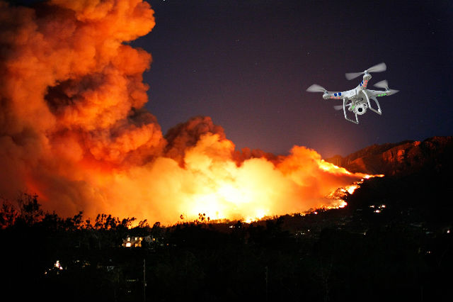
 Rep. Michael Schraa, R-Oshkosh, said he and Sen. Richard Gudex, R-Fond du Lac, proposed the legislation at the request of correctional officers, following a series of cases across the country in which smugglers flew drugs, pornography, or other contraband over prison walls.
Schraa tagged it as a “common-sense legislation,” which will help correctional officers more safely and effectively do their jobs.
However, other speakers at the public hearing in the Senate Committee on Judiciary and Public Safety said the rules would clash with federal regulations and could stifle economic growth potentials from the relatively new technology. Moreover, drone users in Wisconsin protest against no-fly zone bill.
“This bill would create a patchwork of local regulations,” says Consumer Technology Association lobbyist Joe Leibham.
He further explained that the bill, if passed into law, could limit opportunities for commercial drone operators and would conflict with federal authority to regulate airspace.
Prior to this proposed bill, the Federal Aviation Administration (FAA) has beenádeveloping
Rep. Michael Schraa, R-Oshkosh, said he and Sen. Richard Gudex, R-Fond du Lac, proposed the legislation at the request of correctional officers, following a series of cases across the country in which smugglers flew drugs, pornography, or other contraband over prison walls.
Schraa tagged it as a “common-sense legislation,” which will help correctional officers more safely and effectively do their jobs.
However, other speakers at the public hearing in the Senate Committee on Judiciary and Public Safety said the rules would clash with federal regulations and could stifle economic growth potentials from the relatively new technology. Moreover, drone users in Wisconsin protest against no-fly zone bill.
“This bill would create a patchwork of local regulations,” says Consumer Technology Association lobbyist Joe Leibham.
He further explained that the bill, if passed into law, could limit opportunities for commercial drone operators and would conflict with federal authority to regulate airspace.
Prior to this proposed bill, the Federal Aviation Administration (FAA) has beenádeveloping